M. Bonne, cartographer, Map of
Bohemia ca. 1760-1780.
Map is actually 9.5
inches by 15 inches and was found on www.ebay.de by my wife as a birthday
present. I have made two scans – not of
high quality (dpi) but if you would like one of higher quality let me know and
we can get a digital copy made for you for a couple dollars.
1.
Scan
of most of the entire map – 400kb
2.
Scan
of the area around Leitmeritz – 125kb
Older
map, ca. 1800, of the Region – 45kb Another
map that Erich copied and shared with me.
Map of the Böhmische-Kamnitz/Steinschönau Region
This is a copy of a map that Erich copied and sent to me to help me place the various communities around Böh-Kamnitz and Steinschönau. It is 400kb so will take a bit of time on a 56kb modem to load up.
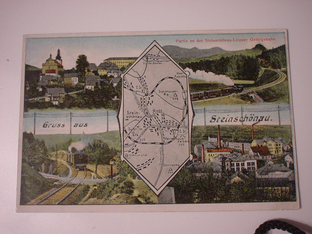
This was
an Ebay find. A great postcard with a
map centered between the four vignettes used in this montage.
Road map of
Steinschönau/Kamenicky-Senov – circa 1945
This map is a copy Erich sent me that survived our house fire in 1999. The map is awesome in its details. The “zu 92” refers to House 92 – one of the Knechtel family homes in Steinschönau – and where my ancestors lived until they immigrated in the 1890s.